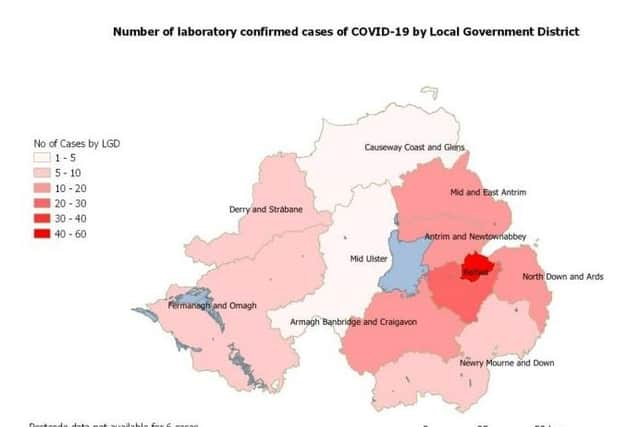
Coronavirus: Latest map of the hotspots for the virus in Northern Ireland shows rate of expansion in a single day


It comes as it announced the confirmed cases in the Province grew by 37 from Tuesday to Wednesday, to reach 209.
There are seven known fatalities.
The virus was first confirmed in Northern Ireland just over one month ago.
Advertisement
Hide AdAdvertisement
Hide AdOf those who have the virus, 34% are aged zero to 44, while 35% are aged 45-69, and 31% are 70-plus.
Males accounted for 56% of the cases, and females for 44%.
Overwhelmingly the most testing has been done in the Belfast health trust area: 1,283 tests – more than twice as high as the next highest trust, the South-Eastern.
There are 465 deaths in the whole UK.
At a global level, Italy has the highest number of fatalities – 7,503 – followed by Spain – 3,445 – and Hubei province in China – 3,163.
To keep up with the global figures, see this link to the world-renowned Johns Hopkins University site.
~~~ NOTE: THIS ARTICLE HAS BEEN SUPERSEDED BY THIS ONE, GIVING THE MAP FOR 26-03-20 ~~~