
Coronavirus: Latest map pinpoints emerging viral hotspots as death toll hits 22 – up by nine since Friday
The Public Health Agency have just released the latest daily report on the coronavirus crisis.
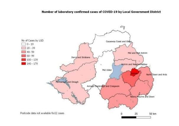
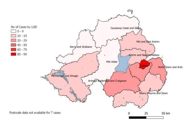
Its map, issued late this afternoon, continues to show a death of cases in the Causeway Coast area and in Mid-Ulster, whilst the south and east of the Province bears the brunt.

The number of deaths as of this morning was 22 (up by one on Sunday).
On Friday it had stood at 13.
The latest age profile of the 533 known Covid-19 cases in Northern Ireland (up by 123 in just a single day) is as follows: 33% – aged 0 to 44
37% – aged 45 to 69
31% – aged 70-plus
51% are male, 49% female.
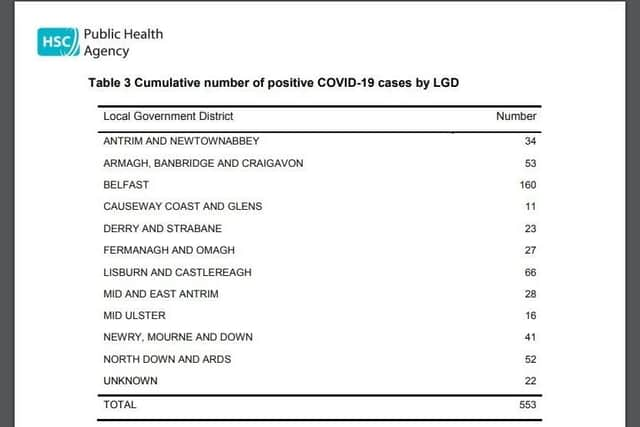
Overwhelmingly, the cases are concentrated in Belfast City Council’s area, which has 160 victims.
The nearest other council area is 66 (Lisburn and Castlereagh).
The vast bulk of tests have also been done in the Belfast trust area: 2,138
The South-East is next with 1,227.
They are followed by the Southern (891), Northern (586) and Western (516).