
Storm Herminia: Homes across Northern Ireland braced to face fresh storm – with over 101,000 NIE Networks customers without power
Homes across Northern Ireland are bracing themselves to face a fresh storm today (Sunday) – many of them without power.
More strong winds and heavy rain are approaching the UK as Storm Eowyn dies down.
The last of Eowyn is pushing across the UK overnight and producing snow and ice warnings in parts of Northern Ireland and Scotland .
Sunday will start "fine and dry" with a "decent amount of sunshine" in many parts of the country.
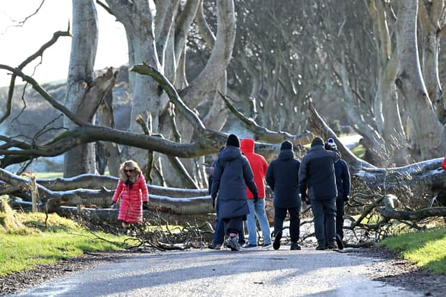

But a new low-pressure system is moving in from the south west bringing further strong winds and heavy rain.
Spanish meteorologists have dubbed it Storm Herminia , as the European country will feel the strongest winds.
It is forecast to hit the south west of England and Wales first and then move into Northern Ireland and northern England on Sunday afternoon, reaching parts of Scotland by the evening.
Met Office meteorologist Jonathan Vautrey said: "This is certainly going to be a notch down compared to Eowyn, whilst there is the potential for 60 to 70mph gusts of wind across the very far south west generally, we're not going to be seeing the same strengths of winds as we have seen over the last couple of days."

Approximately 101,000 customers remain without electricity in Northern Ireland as of 7am this morning.
Power is now restored to 183,000 properties following the devastation caused to the electricity network by Storm Eowyn.
Derek Hynes, Managing Director of NIE Networks explained: “Our restoration efforts are well underway. We are still visiting locations where damage has been caused and are working on the faults that will get power back to the highest possible numbers of homes and businesses
“Assessments carried out on the network yesterday have now enabled us to put restoration details on our website. Please check Power Check on our website (nienetworks.co.uk) for an initial estimate of when we will get power back for your location. We will work to refine these dates and times further as we go through the next few days.
“From what we are seeing so far, we believe that it will be around ten days by the time we complete the repairs needed to get power back to everyone
“Please bear with us as we work through the yellow weather warning over the course of today. We will continue to work with the Strategic and Tactical Co-Ordination groups so that we can avail of as much help as possible from other agencies.”
Councils across Northern Ireland have also opened Community Assistance Centres in their areas at which NIE Networks will be in attendance. These details can be found at www.nienetworks.co.uk.
“Please remember our safety message and do not approach any damaged electricity equipment. Please be extra careful around fallen trees as they often take electricity poles and wires with them as they fall and call us if you see anything that looks dangerous on 03457 643 643.”
Ministers from across the UK held an emergency Cobra meeting on Saturday to co-ordinate recovery efforts, and extra engineers were dispatched from England to Northern Ireland and Scotland .
"Obviously places maybe currently have a bit of a lower threshold for wind strengths at this stage, following all the disruption and damage that's been put in place", Mr Vautrey said.
"It is something that people certainly need to be wary of, and still taking care of, as we head into Sunday and into the start of the new working week as well - the risk of localised flooding, further flying debris and travel disruption is possible as a result of all of this."
The low-pressure system will linger through Monday and Tuesday bringing outbreaks of rain, occasional heavy showers and blustery winds in places.
A yellow warning for wind is in place in the south-east, south-west and north-west England , as well as Wales and south-western parts of Scotland , from 8am to 3pm on Sunday .
Gusts of 50mph to 60mph are expected widely and they could reach 70mph on exposed coasts and hills, the Met Office said.
Another yellow warning for "strong and gusty winds" will be active from Monday at 6am until the same time on Tuesday in the east, south-east and south-west of England and Wales .
Most of central and southern England and much of Wales have a yellow warning for heavy rain in place from 8am on Sunday to 6am on Monday , bringing a chance of local flooding for parts of the UK.
The Met Office warned 10 to 20mm of rain will fall, nearing 30 to 50mm on high ground.
A further heavy spell on Sunday evening could bring as much as 80mm.
"Given recent heavy rain, this extra rainfall could lead to some local surface water and river flooding", the Met Office said.
The West Midlands and most of Wales have a yellow heavy rain warning between 6am and 11.59pm on Monday .
The Met Office said yet another low-pressure front will pick up on Wednesday and again arrive in the south-west.
Mr Vautrey said: "South-western areas certainly bearing the brunt this time in terms of the most unsettled conditions.
"The first half of next week, still pretty unsettled."
There are tentative signs of calmer weather for much of the UK next weekend, he added.
Storm Eowyn has been "somewhat extraordinary", the meteorologist said.
Multiple weather systems are arriving at the same time because of the placement of the jet stream, he added.
"It's being fuelled by the cold wave that they've had recently over the United States and Canada , and that contrast between the cold air there, and the mild air pushing in from the equator is helping to fuel this very powerful jet stream across the Atlantic at the moment.
"It's the exact positioning of the jet stream that determines who sees the low pressure and who sees the strongest winds.
"Initially it helped steer Eowyn up towards the north west of the UK, and so we saw the strongest winds from that (there).
"Whereas with this next system that the Spanish have named, because the jet stream is just slightly further south now, it's pushing it a little bit more to the south of the UK, but into parts of continental Europe as well - that's why they're seeing the strongest winds".