Weather: 'Cooler than average temperatures' coming next week accompanied by wintry hazards
and live on Freeview channel 276
Today, Met Office spokesman Stephen Nixon, said ‘people in Northern Ireland should expect some lower than average temperatures for this time of the year, next week.
"Looking further ahead, into next week, it is remaining very cold for most of Northern Ireland,” he added.
Advertisement
Hide AdAdvertisement
Hide Ad"At the start of next week, there is a Northerly air flow and temperatures will be well below average for Northern Ireland.
"That will increase wintry hazards at times whether that comes in the shape of sleet or snow”.
"That has yet to be determined,” he added. “But cooler than average temperatures will remain in charge for much of the UK and Northern Ireland for much of January.
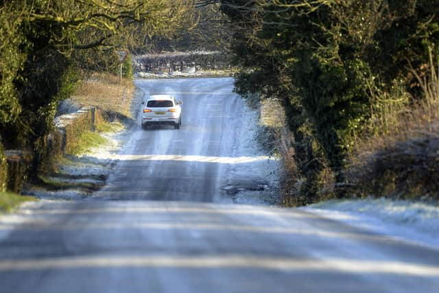
"This week will be cold and dry largely, with perhaps some wintry showers,” he added. “It could dip to -5°C at night this week, but there is more of a chance of snow next week.
Advertisement
Hide AdAdvertisement
Hide Ad"At this stage it is hard to know whether this is going to come off”.
Today it has been forecast that ‘skies will remain clear into this evening and for most of the night, allowing some fog patches to form’ and there will be a minimum temperature -3 °C’.
Wednesday will start with ‘cloud feeding in from the east and a few light showers at times’ and a maximum temperature of 5 °C.
And, in England, the weather service has issued a yellow warning for ice across southern England and South Wales, which will last from 3pm on Monday to 3am on Tuesday.

Advertisement
Hide AdAdvertisement
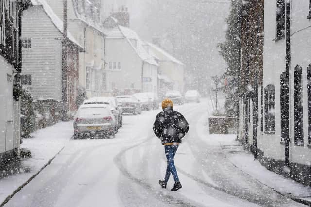
Hide AdIt came as parts of southern England, including London and Kent, saw snowfall on Monday morning in a cold start to the week.
Met Office meteorologist Tom Morgan said that not much of the snow appeared to have settled, with some areas seeing a “dusting of maybe one centimetre or two of snow”.
He added that Tuesday would be drier with limited snowfall, apart from some wintry showers in Cornwall.
The forecaster said a cold wind coming in from the east means there will be a “significant wind chill” again on Tuesday, which will make temperatures feel more like minus 3C in the South West of England.
Advertisement
Hide AdAdvertisement
Hide AdHe told the PA news agency: “We’re not expecting much in the way of further snowfall on Tuesday. In actual fact, it will be much sunnier than today, particularly in the south compared to Monday.”
Mr Morgan said there was a risk of ice in some areas because the ground “is still quite wet” after several weeks of wet weather.
He added: “We are likely to see some icy patches tonight, particularly in South Wales and southern parts of England.”
The Met Office forecaster said a blast of cold air coming down from the north, mostly affecting Scotland, was likely to bring more cold conditions over the weekend with some snow showers.
Advertisement
Hide AdAdvertisement
Hide AdThe wintry weather comes after Prime Minister Rishi Sunak visited flood-hit residents in Oxford, and as Environment Agency workers are still trying to mop up from the heavy rainfall and high winds during Storm Henk last week.