NI Snow Map: Heavy snowfall, sleet and ice forecast for most parts of NI - temperature to feel as cold as -7°C


The green area in the map of Northern Ireland below denotes which parts of the Province are most likely to see snowfall over the next 48 hours.
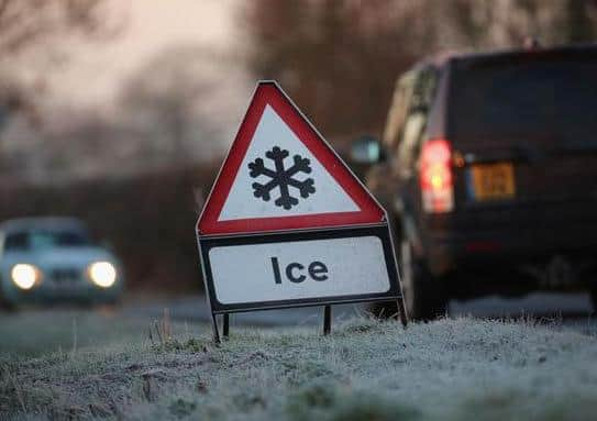
However, snow isn't the only thing people should be concerned about.
Advertisement
Hide AdAdvertisement
Hide AdFeels-like temperatures in some parts of Northern Ireland will drop as low -7°C overnight. This means the widespread formation of ice could significantly disrupt busy transport routes.

The current yellow status weather warning from the Met Office until 11.59pm on Tuesday however a further yellow status alert for snow and ice has been put in place for between 12.00am and 12.00pm on Wednesday.
In recent weeks, most of snow to fall in Northern Ireland did so on high ground however the Met Office believe lower levels could well see snow over the coming days.
"Fresh snow gathering away from lowest levels, but even here chance of some later slushy deposits," reads the Met Office weather forecast for Northern Ireland online.
Advertisement
Hide AdAdvertisement
Hide AdTuesday will be bitterly cold with gale-force winds coming in from the west with a chance of snow settling on lower levels.
Interestingly, Northern Ireland could well see snow from now until the end of the week, according to the Met Office.
"Wintry showers dwindling from south on Wednesday as winds ease.
"Thursday brings an area of light rain and snow for a time.
"Rain and gales for Friday," predicted the Met Office.
Belfast will see sleet showers in the early hours of Tuesday with the heavy snow forecast to fall between 9.00am and 11.00am.
Advertisement
Hide AdAdvertisement
Hide AdMuch like Belfast, Londonderry will see a combination of rain and sleet overnight with heavy snow expected to feature at 9.00am on Tuesday.
Lurgan and Portadown look set to see persistent heavy snowfall between 9.00am and shortly after 11.30am on Tuesday and the feels like temperature is expected to drop to as low as -5°C.
If you live in the Mid-Ulster area and thought you might escape the worst of the white stuff then think again.
Cookstown will drop below zero degrees centigrade on Tuesday morning with heavy snow due early in the morning and expected to last well into the afternoon and evening.
Advertisement
Hide AdAdvertisement
Hide AdLarne, Carrickfergus and Newtownabbey should see heavy snowfall during Tuesday morning rush hour with ice formation making driving condition significantly more treacherous.
Lisburn will feel as cold as -6°C on Tuesday morning and a mixture of heavy and light snowfall throughout most of the day.
To stay up to date with the weather forecast and weather warnings in your area visit www.metoffice.gov.uk