
Northern Ireland may experience an official heatwave this week, says Met Office
Parts of Northern Ireland could experience an official heatwave this week, according to the Met Office.
It comes as the Met Office has issued a rare red weather warning for Wednesday and Thursday for central and southern England and Wales in the face of extreme heat and humidity.
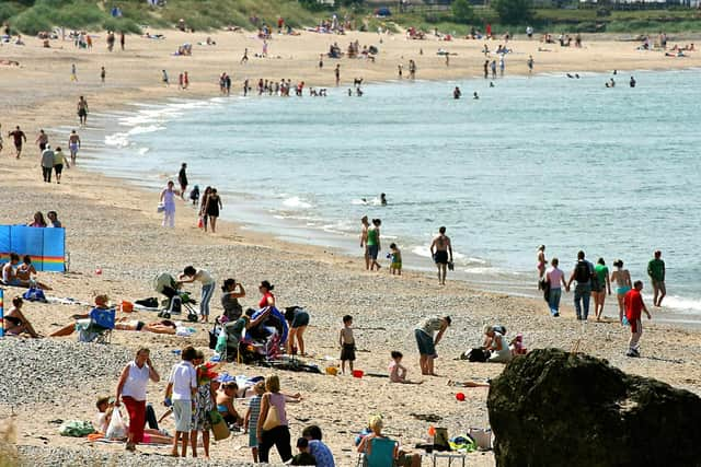

Temperatures in Northern Ireland will be much milder - but still up to 10C higher than average in some places.
The weather forecaster said this week’s heatwave will see temperatures in GB exceed 37C in the shade and could even see them rise to 38C to 40C in some parts of England and Wales.
The hot conditions, which have been very rare in the UK until now, will be accompanied by high humidity, and very warm and humid nights.
A red heat health alert has been issued for six regions of England during the forecast heatwave on Wednesday and Thursday, indicating “a risk to life for even the healthy population”, the UK Health Security Agency said.
Met Office spokeswoman Natalia Wells told the News Letter: "There is a chance of some parts of Northern Ireland reaching heatwave criteria by Thursday."
A heatwave is an extended period of hot weather relative to the expected conditions of the area at that time of year, which may be accompanied by high humidity.
Temperatures may range from 25-27C for Northern Ireland from Tuesday to Wednesday, she said. For NI, a heatwave is three or more days where the temperature reaches 25C or above.
By contrast, The NI average maximum temperature for June is 17.2C.
In Northern Ireland Monday was to brighten up after a cloudier start, bringing some warm sunshine and a maximum temperature of 23C.
"Tuesday will be a dry and fine day for many" she added.
"Cloud builds up later in the day, but remains very warm on Tuesday with a maximum temperature of 25C possible.
"The rest of the week sees a very warm few days, reaching a maximum temperature of 25C on Tuesday while Thursday could be very hot and reach 27C."
"Later in the day on Thursday and on Friday, some thundery showers are possible."
Temperatures on Saturday are expected to reach 20C and 18C on Sunday.
"More widespread showers and cloud cover are also possible into the end of the week," she added.
As part of the Red Warning for England and Wales, forecasters say conditions will bring a risk to life and population-wide health impacts that no longer limited to those most vulnerable to extreme heat while “substantial changes” in working practices and daily routines will be required.
There is also a high risk of failure of heat-sensitive systems and equipment, with the loss of power and other essential services, such as water, electricity, gas or mobile phone services.
Chloe Brimicombe, climate scientist and heatwave researcher at the University of Oxford, said: “It is possible that for a second month in a row record temperatures could be broken – which is quite alarming.”
The Met Office says that heatwaves are extreme weather events, but that research shows that climate change is making them events more likely.
A new record-high temperature for the UK of 40.3ºC was recorded at Coningsby in Lincolnshire on the 19 July 2022, along with new records for Scotland on the 19 July and Wales on the 18 July.