
Northern Ireland weather: Get prepared to wear your holiday clothes at home this week during 'heatwave conditions'
Temperatures are expected to rise to heatwave levels this week, after a week of non-stop warm weather, in Northern Ireland.
In amazing news from the Met Office forecaster is Aidan McGivern said that ‘temperatures are rising’ and ‘Northern Ireland and Scotland will see brighter skies’.
He added that tomorrow (Wednesday) will be a ‘bright day with plenty of sunshine after a few spots of rain in Northern Ireland’ adding that the temperature will be ‘in the high teens and low 20s in places’.
‘We do have rising temperatures across the whole of the UK, initially because of high pressure across the whole of he country,” added Mr McGivern.
‘We will have rising temperatures, but by the end of the working week we will have a change as the high pressure pushes into the north sea.
‘There is the potential for temperatures to be in the low 30s by Saturday,’ he added.
This weekend much of the UK will be in heatwave conditions, according to the Met Office.
They said heat will build through the week.
And on Wednesday the highest temperatures values in the UK are expected to be around 27ºC.
Whilst on Thursday this will rise to 29ºC and by Saturday increasing more locations will exceed heatwave values, with the highest temperatures expected to exceed 30ºC.
And the Met Office Northern Ireland says that this morning we saw a ‘cloudy start with patchy light rain soon clearing, then a brighter day with sunny spells developin’.
They add that it will be ‘dry most of the time with just a few light passing showers’ and a maximum temperature of 21 °C.


Tonight, ‘most places will have a dry night with clear periods although becoming rather cloudy later’.
They adds that there ‘may be a little drizzle in the west by morning... Minimum temperature 9 °C’.
And tomorrow (Wednesday) ‘most places will have a dry day and it will be rather cloudy’ and ‘thicker cloud may bring a little drizzle to the North Coast’.
There will be ‘light winds and a maximum temperature 19 °C’.
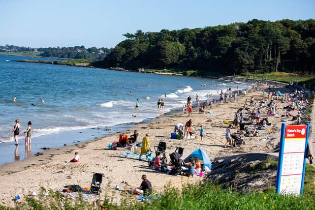
The outlook for Thursday to Saturday is that ‘high pressure will bring a mainly dry few days with plenty of sunshine’.
The Met Office add that there ‘may be a few showers, especially on Friday’ and it will ‘become very warm’.
Meanwhile it is not looking great for those who suffer from hay fever with pollen counts registering as H over coming days.
The news comes as Britons are set to bask in a heatwave this weekend, with some places hotter than parts of southern Europe.
Forecasters are expecting temperatures to soar to 32C in the south of the UK by Saturday – and most places will reach temperatures above the heatwave threshold by the weekend.

An official heatwave is recorded when areas reach a certain temperature for three consecutive days, with thresholds varying from 25C to 28C in different parts of the UK.
In London – where the threshold is 28C – temperatures could peak at 29C on Thursday and 31C on Friday, before hitting 32C on Saturday.
The hot weather will then spread further north, with Manchester and Newcastle enjoying temperatures into the late 20s by the weekend.
The Met Office said several places were expected to exceed 30C on Saturday, making them the highest temperatures of the year so far.
Tony Wisson, a deputy chief meteorologist at the Met Office, said: “Over the next few days, settled weather and warm sunshine will allow temperatures to rise day on day.
“Temperatures will then rise further towards the end of the week as winds turn more southerly and even warmer air over continental Europe will be drawn across the UK.
“While the warmest temperatures are likely across London and the east of England, by Saturday heatwave thresholds could be reached across much of the Midlands, low-lying areas bordering the Peak District and even parts of east Wales.”
The heatwave means some parts of the country will surpass temperatures in holiday hotspots such as Lisbon in Portugal and Barcelona in Spain, which are predicted to reach 29C on Saturday, and Nice, France, where it will be 30C.
Forecasters have warned some rain is still possible in parts by the end of the week, with localised, heavy showers forecast depending on how humid it gets.
The burst of heat is expected to peak this weekend before easing early next week, with high pressure expected to move away from the UK resulting in falling temperatures.
Mr Wisson added: “Some forecast models even allow temperatures to rise into the mid-30s by Monday. While this is feasible, it is considered a lower-likelihood scenario.”
Looking further ahead – Saturday 21 Jun - Monday 30 Jun – the Met Office say that ‘very warm or hot conditions will likely be the focus of the weather over the weekend and into the start of next week’.
‘Temperatures could remain in the low thirties of Celsius across parts of England, with a small chance of approaching mid thirties in some places.
‘Heatwave thresholds may continue to be exceeded across parts of the UK at first.
‘Temperatures overnight will also be very warm and perhaps humid for much of the UK.
‘Across the west of the British Isles, cloudier conditions could bring showers with the odd lightning flash.
‘Winds will also be light for most, and moderate around coasts further west.
‘From early mid week, signs are the heat will ease, with rain and showers, and less hot conditions, perhaps moving in from the west’.
And looking even further ahead – Tuesday 1 Jul - Tuesday 15 Jul – ‘The wettest and windiest conditions are most likely to be focus across the in north and west, with a risk of some heavy rain at times, mainly over hills.
‘Broadly settled across the south and east, although some rain may spread across from the north or west at times.
‘Temperatures are expected to be near to or above norma
‘As is normal for the time of year, there is a chance of hot spells returning across the south and east, which also could lead to the risk of heavy showers or thunderstorms.’