NI Centenary Parade: Mile-by-mile layout of the route for bandsmen and brethren with landmarks for out-of-towners
and live on Freeview channel 276
The entire Stormont-to-City Hall route clocks in at almost exactly 4.5 miles (7.2km) – a walk which most younger marchers will take in their stride, but which could test less youthful bandsmen who will be carrying chunky instruments for the duration of the route amid the warmth of late spring.
To help brethren and bands keep track of their progress, the News Letter here presents a mile-by-mile map of the route, based on a starting point of Carson’s statue at Stormont.
Advertisement
Hide AdAdvertisement
Hide AdFor those from outside Belfast, the News Letter has included street names and landmarks near to each milestone.
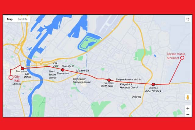

Mile one is almost exactly at Cabin Hill Park, on marchers’ left;
Mile two is at North Road, to both the right and left of the parade;
Mile three is at Chadolly Street to marchers’ right, next to Bethany chippie;
And mile four is roughly at Musgrave PSNI Station.
Advertisement
Hide AdAdvertisement
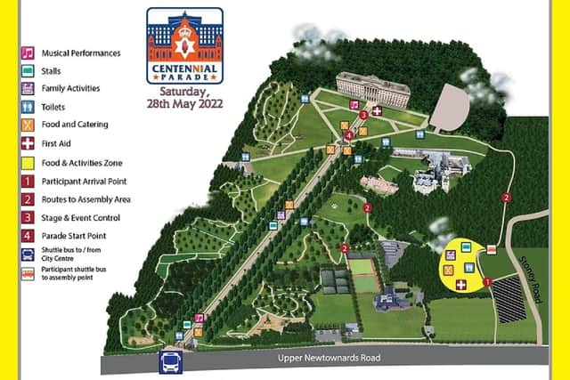
Hide AdIn addition, the Orange Order has produced a map showing the location of amenities at Stormont.
More from this reporter: