
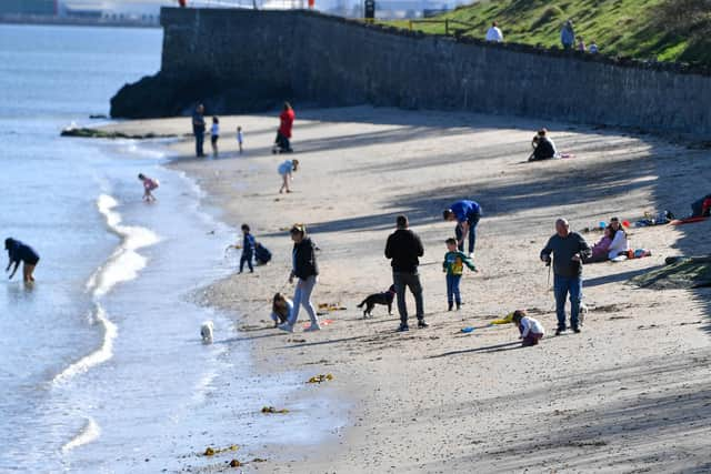
Northern Ireland Weather: Virtually cloudless skies today as the first day of April brings 'clear skies and warm sunshine for many'
Northern Ireland is expected to remain under relatively cloudless skies for the next few days with temperatures staying around 17C today, 16C tomorrow, 17C on Thursday, 18C on Friday before temperatures drop off into the weekend with highs of 15C.

The Met Office say ‘the first week of April will see clear skies and warm sunshine for many, though a breeze and cold seas will make coastal areas slightly cooler’.
With high pressure becoming established this week, the start of April will be warm and sunny across the UK,’ the Met Office add.
‘With the area of high pressure situated to the northeast of the UK, there will be a strong breeze across the southern half of the UK through the start of the week.
‘In windward coastal areas this will make things feel a little cooler as the sea surface temperatures have yet to recover from their coldest time of the year’.
The Met Office Northern Ireland says that today (Tuesday) will be ‘dry with long sunny spells and breezy’
Tuesday started ‘a dry and bright day with plenty of sunshine across all parts’ yet also ‘a breezy day with fresh southeasterly winds, strong along the east Antrim coast’.

There will be a maximum temperature 17 °C.
And tonight, according to Oli Claydon from the Met Office ‘overnight temperatures will feel chilly with rural areas close to freezing tonight and tomorrow night under cloudless skies’.
There will be a minimum temperature of 3 °C.
Tomorrow (Wednesday) will be ‘another dry and sunny day across all parts’ that will ‘feel rather warm in the west but cooler towards the east coast with an easterly breeze’.

There will be a maximum temperature 16 °C.
And the outlook for Thursday to Saturday, according to the Met Office is ‘dry with plenty of sunshine for most places during this period’ where ‘a few showers may spread up from the south for a time on Thursday night’.
And in the Met Office long range forecast from Saturday 5 Apr - Monday 14 Apr meteorologists say that ‘high pressure will tend to dominate through this period, often centred to the north or northeast of the UK, maintaining largely settled conditions for much of the time.
‘This should result in lengthy spells of dry and bright weather, but with a risk of patchy overnight frosts where winds fall light.

‘There is also the chance of some areas of low cloud or fog, especially around some coasts.
‘Later in the period, it may turn more unsettled at times as rain or showers try and push in from the west.
‘It will be breezy at times, especially in the southwest early on.
‘Daytime temperatures will tend to fluctuate depending on the wind direction and cloud amounts, with the potential for warm conditions at times but also cooler interludes.’
And the period Tuesday 15 Apr - Tuesday 29 Apr is giving: ‘Weather patterns are most likely to remain fairly slow-moving through the second half of April.
‘High pressure may remain centred to the north or northeast of the UK, potentially bringing more fine and dry weather.
‘However, there may also be some interludes of rain or showers, these perhaps more likely to affect southern and western parts of the UK.
‘Temperatures are likely to be around or a little above average overall, and feeling warm inland at times during the day, although some chilly nights are still possible under any clear skies.’