
Storm Chandra: Persistent heavy rain, flooding and high winds of 75mph with a Yellow Weather warning for ice and snow also forecast
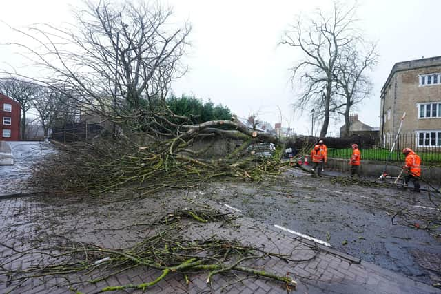
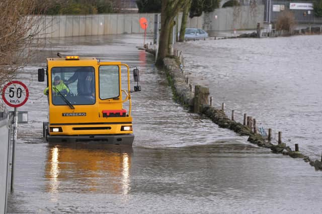
Amber and yellow warnings are in place for a number of areas today, for wind, rain and snow, as Storm Chandra continues.
Met Office meteorologist Alex Deakin added that ‘winds will pick up over Northern Ireland’.
The ‘greatest concern is strong winds in the east of Northern Ireland with gusts of 60/70/75mph likely to cause some structural damage’.
Today an amber weather warning is in place for NI between 5am and 9pm today were the Met Office say ‘Storm Chandra will bring very strong winds, leading to the potential for damage and disruption on Tuesday’.
The news comes as another Yellow weather warning was issued for Northern Ireland tomorrow between 3am on Wednesday 28 Jan and 10am on Wed 28 Jan 2026.
‘Ice will form overnight Tuesday and may lead to some disruption through Wednesday morning,’ the Met Office warn.
Today, according to the Met Office Northern Ireland there will be ‘persistent, heavy rain, showers later’ and ‘windy, coastal gales’.
Today will be ‘cloudy with outbreaks of rain, some hill snow, heavy and persistent’.
They say ‘the rain will clear from the southwest by the afternoon’ but ‘frequent showers, some heavy, will follow later in the afternoo’.
It will also be ‘windy with coastal gales east’ and a ‘maximum temperature 7 °C’.
And tonight ‘frequent evening showers clear by midnight leaving the night dry with clear spells’.
It will be ‘windy with coastal gales in the east at first’ and a minimum temperature 2 °C.


And tomorrow (Wednesday) ‘most places will see a dry day with bright or sunny spells’.
‘Cloud will spread north during the afternoon with showers in the south later’ and a maximum temperature of 7 °C.
The outlook for Thursday to Saturday is ‘bright spells with showers at times later Thursday’ but ‘outbreaks, rain with hill snow, some heavy Friday’.
It will be ‘drier and brighter at first on Saturday becoming cloudy with rain later’.
The outlook for Saturday 31 Jan - Monday 9 Feb is: ‘Weather systems from the Atlantic will continue to attempt to push in from the west, but tending to stall in the vicinity of the UK as they encounter high pressure to the north and northeast.
‘As a result, further spells of rain or showers as well as strong winds are expected at times.
‘Rain may be heavy and persistent, especially in the south and west.
‘Whilst mild conditions are expected to encroach into the south and southwest at times, cold air is likely to be positioned to the northeast, bringing wintry showers at times.
‘Where fronts from the southwest do reach the cold air towards the northeast, there is the risk of some snow, most likely across hills, but perhaps extending to lower areas at times’.
And the outlook for Tuesday 10 Feb - Tuesday 24 Feb is: ‘A similar theme from early February is most likely to continue as Atlantic frontal systems attempt to move across the country.
‘With the jet stream likely further south than normal, the wettest conditions are more likely in central and southern areas.
‘North and northwestern parts of the UK are most likely to be drier than normal.
‘Whilst mild incursions of wet and windy weather are favoured at times in the south and west, colder conditions in the north and northeast will bring an increased risk of wintry hazards, especially where any precipitation from the southwest interacts with the cold air’.