
Northern Ireland weather: Another Yellow Weather Warning from Met Office with a minimum temperature of -4 °C tonight as 'Arctic air continues to dominate'
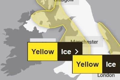
The Met Office has issued a third Yellow weather Warning for Northern Ireland – this time for ice.
The latest warning for parts of Northern Ireland is in place from 4pm today to 10am tomorrow. See it here
The warning which has just been issued advises that it will remain ‘cold on Wednesday’ with ‘bright spells and scattered wintry showers, particularly over northern counties’.
It adds that there is a ‘chance of hail and thunder’, ‘will feel cold in the brisk northwesterly winds’ with a ‘maximum temperature 4 °C’.
And tonight the Met Office adds will be ‘for many places a dry and clear night allowing a hard frost to develop’.
‘Wintry showers continue near the North Coast’, they add with a minimum temperature of -4 °C’.
Tomorrow (Thursday) will see ‘bright spells and further wintry showers, particularly in the north, merging into some longer spells of sleet and snow later’, according to forecasters.
They add there will be ‘occasionally fresh west to northwest winds’ and a maximum temperature of 5 °C.
Lastly the Met Office says the outlook for Friday to Sunday is: “Mainly dry and bright on Friday after early coastal showers.
"Windy with rain and hill snow on Saturday. Staying windy with bright spells and scattered showers Sunday.”
Yesterday Met Office spokesperson Nicola Maxey said: “It is going to be a cold week both day and night with temperatures of -5° C or -6° C overnight in the countryside and exposed areas and city dwellers to see -2° C or -3° C as we go through the week.

She said during the day temperatures should remain 5° C or 6° C but “there is a wind chill factor through the week which means the temperatures feel even colder”.
The Met Office spokesperson added: “This is a time for preparation – be aware and check your driving route before you travel to make sure the roads are not impacted and you have equipment in your car to keep you safe and plan for the cold weather in case you are stuck in your car for a while.”
Meanwhile more information released from the Met Office this afternoon says: “Fresh warnings for snow and ice have been issued by the Met Office as Arctic air continues to dominate the UK’s weather.
"A northerly airflow is continuing to subdue temperatures for the UK, with sub-zero figures likely for many over the next few nights and low single figures in the day for many.
"A number of Met Office National Severe Weather Warnings have been issued for snow and ice, with the highest accumulations of snow likely over high ground in Scotland, but still providing some disruption at lower levels at times.
"Snow is also likely in parts of the southwest through Thursday.”
Met Office Chief Meteorologist Matthew Lehnert added: “A northerly airflow will continue to feed snow showers into Scotland over the next few days, with this reaching lower levels at times and bringing the potential for some travel disruption.
“Overnight temperatures will drop below zero fairly widely over the next few days, which has resulted in some ice warnings, with further warnings likely through this week.
“On Thursday, a mixture of snow, sleet and rain is likely to affect the southwest which could potentially bring disruption. It’s likely high ground in the area will see snow, with a mixture of conditions likely at lower levels. 2-5cm of snow is possible in places at lower levels, with around 10cm possible over higher parts of Dartmoor.”
RAC Breakdown spokesperson Alice Simpson said: "The first taste of winter means drivers are suddenly contending with the some of the worst road conditions we’ve seen all year.
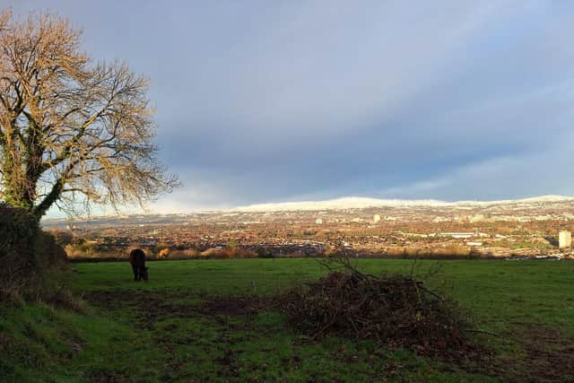
"With freezing temperatures already causing disruption in the east and north of England, Wales, Scotland and Northern Ireland, and snow showers now affecting regions further south, we advise motorists to plan well as ice forms on untreated surfaces.
“Drivers should ensure their tyres have plenty of tread and are inflated to the correct pressure to give them the best possible grip on the road.
" It’s best to stick to major roads, rather than rural areas where surfaces may not be gritted, reduce speeds and leave plenty of space behind the vehicle in front to ensure you have more time to stop.
"Everyone should travel prepared in case they find themselves broken down at the side of the road: a blanket, warm waterproof coat and gloves, sturdy footwear and a charging cable and mobile power bank are all essentials.”
A Met Office spokesman added: “Friday will see a brief respite for some, while snow showers will continue to feed into northern coastal areas, topping up snow accumulations over high ground but reaching lower levels at times.
"However, Saturday will see a shift to more widely wet and windy conditions, with warnings already issued to highlight potential disruption from rain and snow.”
And according to the Long Range Forecast covering Saturday 23 Nov - Monday 2 Dec: “After a cold start with increasingly cloudy skies into the weekend conditions turn more to rain, sometimes heavy, with strong winds.
"On the leading edge of this some brief snowfall is possible, this more likely across parts of northern Scotland.
"Strong winds and blustery showers, especially in the west close the weekend before a more settled period develops.
"Late in the month there's still potential for more organised bands of rain and stronger winds, with some wintry conditions possible, though most snow limited to northern hills.
And across the water in England snowy conditions have forced the closure of more than 200 schools and led to widespread travel disruption.
The Met Office has put in place a yellow warning for ice for much of southern England, the Midlands and eastern Wales from 5pm on Tuesday to 10am on Wednesday.
Several other warnings for snow and ice are in force across the UK, with the Met Office advising that vehicles could be stranded, power cuts may occur and rural areas could be cut off.
The UK Health Security Agency (UKHSA) has issued the first amber cold weather health alert of the season, warning conditions could be dangerous for vulnerable people, including the elderly.
The amber warning covers the east and north of England, the Midlands, and Yorkshire and the Humber, with yellow alerts coming into place for the South East, South West and London until 6pm on Saturday.
Met Office Chief Meteorologist Neil Armstrong said: “With cold Arctic air firmly in place over the UK, continued winter hazards are likely through much of this week, with further updates to warnings likely in the coming days.”