
Northern Ireland Weather: Easter Sunday 🐇 to be 'driest day' of the long weekend with possible return to wall-to-wall sunshine later in week
Northern Ireland welcomed a bright morning – albeit with scattered showers – and light winds.
As we enter the bank holiday weekend, the weather is set to be changeable, and is certainly in contrast to the wall-to-wall sunshine we experienced last weekend.
But, according to Alex Burkill from the Met Office we will only see the return to the more settled weather we are all craving next week with the return of high pressure.
So, the meteorologist confirms that ‘after a bit more rain through the Easter weekend, more settled weather should return’.
He added that ‘Good Friday looks like the wettest day of the long weekend’ in Northern Ireland but that ‘Easter Sunday looks like a pretty decent day for many, particularly if you are planning an Easter Egg hunt and the driest day of the long weekend for many because there is another band of low pressure tracking its way in’.
And Oli Claydon from the Met Office says: “It is a pretty mixed weekend of weather for Northern Ireland with low pressure never far away.
"We have a band of rain moving in from the south west overnight tonight which will bring rain into all areas of Northern Ireland through Friday morning, it’ll also be quite breezy too.
"The rain could be heavy at times, especially over higher ground.
"The rain will fragment into showers through the afternoon but persist into the evening and overnight.
"Highs of 10C tomorrow (Friday).
"Saturday will remain showery with plenty of cloud around too though there will be the odd brighter spell particularly in the north.


"Sunday will be similar with showers scattered across Northern Ireland with occasional bright spells in the north and east.
"Highs of 11C on Saturday and Sunday.
"Monday’s forecast is a little more uncertain with the position of an area of low pressure dictating the conditions. It is likely to remain changeable with showers and spells of sunshine”.
Meanwhile the Met Office Northern Ireland says that today (April 17) ‘will be a bright day with sunny spells and a scattering of showers’ ‘any showers could be heavy and the winds will be light’.

The maximum temperature is forecast as 12 °C.
And tonight we will see ‘any showers dying out during this evening with clearing skies’ and ‘a few shallow mist patches possible before cloud thickens from the south overnight with patchy rain or showers by dawn’ and a minimum temperature of 6 °C.
Tomorrow (Friday 18 April) will be ‘mostly cloudy with outbreaks of rain, the rain heavy and persistent at times over the hills’.
The Met Office ass that it will ‘feel chilly in the brisk east or northeast winds’ and there will be a maximum temperature of 10 °C.
The outlook for Saturday to Monday is ‘rather cloudy with occasional rain or showers’ but there will be ‘some drier and brighter spells too, the best of these across the north’.
However, there will also be ‘chilly easterly winds’.
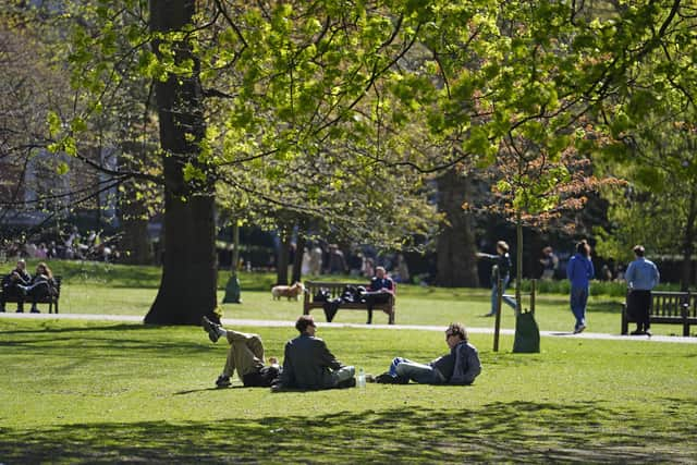
But Deputy Chief Meteorologist Steven Keates said: “The Easter weekend is set to bring changeable weather for many.
"Some areas may experience near dry conditions all weekend, whilst others may see heavy rain.
“We are keeping a close eye on an area of low pressure which sinks away to the south on Friday.
"This could bring with it some heavy, and possibly even disruptive rain for parts of southwest England, and also parts of Northern Ireland and south Wales.
"This will bring the potential for some difficult travelling conditions, with a lot of spray on the roads, and it’s important people keep an eye on our forecast as things evolve over the coming day or so.”
Steven added: “The low will pull away to the south on Saturday, although the speed and time of the clearance is rather uncertain at the moment.
"Some rain may linger across parts of the west/southwest but elsewhere, many parts will enjoy some sunny spells, with light winds and temperatures around average.
“Easter Sunday looks to be the widely drier day of the weekend.
"Cloud amounts will vary, but most places should see some bright or sunny spells at times. Parts of the far south and west may remain cloudier with a few showers around. Temperatures look generally close to the seasonal average.
“Things probably turn a little more unsettled again on Monday, with outbreaks of rain/showers in the south and west, tending to spread northwards and perhaps becoming heavy at times, though there is currently a lot of uncertainty in the details.”
And looking further ahead – Monday 21 Apr - Wednesday 30 Apr – ‘Many areas look to be rather showery at the start of this period, with the heaviest and most frequent showers more likely in the south.
‘With time, this showery theme should become more confined to southern areas as pressure builds from the north, and by the final weekend of April high pressure may dominate most of the UK.
‘This means a gradual increase in the extent of dry and for some, sunny conditions, though other areas may be rather cloudy at times.
‘Where skies are clear overnight, some late season frost remains possible.
‘It is possible that by the end of April, warmer conditions may develop, either through increased amounts of sunshine day on day or through a southerly airflow becoming established’.
And from Thursday 1 May - Thursday 15 May the Met Office say: ‘Early May will probably see a good deal of settled weather with high pressure patterns most likely to dominate.
‘Whilst some spells of more unsettled weather are possible at times, these perhaps more likely towards mid-May, much of the period is expected be largely fine and dry. T
‘Temperatures are expected to be near or slightly above average overall’.