Storm Eunice Northern Ireland: Weather forecast for Northern Ireland as Met Office warns of snow and wind
and live on Freeview channel 276
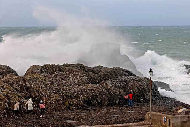
Storm Dudley caused disruption across Northern Ireland on Wednesday, bringing down trees and leaving many residents without power.
Storm Eunice is now also on its way and brings with it a yellow warning from the Met Office for wind and snow, coming into force on Friday, February 18 from 3am until 6pm
Advertisement
Hide AdAdvertisement
Hide AdThe Met Office have said: "Storm Eunice may cause disruption due to heavy snow and some strong winds on Friday."
Here's everything you need to know about the weather forecast for Storm Eunice in Northern Ireland.
What is the weather forecast for Thursday?
The Met Office have forecast that on Thursday there will be, 'Some bright or sunny spells and occasional showers, these mainly at first and again for a time in the afternoon.'
The showers will become, 'wintry at times,' with a, 'maximum temperature 6 °C.'

Advertisement
Hide AdAdvertisement
Hide AdThursday evening is where we start to see wintery weather across the province, with the Met Office predicting, 'widespread sleet and snow will spread northeast in the early hours, although rain likely along some coastal areas.' With a, 'Minimum temperature 0 °C.'
The yellow weather warning for wind and snow will come into force at 3am on Friday, February 18.

What is the weather forecast for Friday?
The Met Office have predicted that Friday will see, 'widespread sleet and snow in the morning will clear away eastwards to leave a brighter afternoon with wintry showers.'
There will be, 'strong to gale northerly winds, upland blizzards in the morning.' with a maximum temperature 4 °C.'
Advertisement
Hide AdAdvertisement
Hide AdThere will be a yellow weather warning in place on Friday from 3 am until 6pm.
People are recommended to take additional precautions when travelling, especially in wintery conditions.
What to expect from a yellow weather warning?
The Met Office have outlined a few things to expect and prepare for, regarding Friday's yellow weather warning for snow and wind.
There is a chance of travel delays on roads, possibly with stranded vehicles and passengers, along with delayed or cancelled rail and air travel
Advertisement
Hide AdAdvertisement
Hide AdThere is a slight chance that some rural communities could be temporarily cut off
There is a small chance that power cuts will occur and other services, such as mobile phone coverage, may be affected
What to do when travelling in snow or ice
The Met Office have recommendations on how to stay safe when travelling through snow or ice.
Before snow or ice:
If you have to make a journey when snow is forecast, make sure you have warm clothes, food, water, boots, a torch and spade, and let someone know when you expect to arrive and your route. Try to wait until the roads have been gritted before travelling
Advertisement
Hide AdAdvertisement
Hide AdPut grit or cat litter on paths and driveways to lessen the risk of slipping on compacted snow
Check on vulnerable neighbours
During snow or ice:
Avoid travel if possible
If you must drive check the Highway Code for advice on driving in ice and snowy weather. A summary of the advice is: Take care around gritters. Don't be tempted to overtake. Slow down - it can take 10 times longer to stop in snowy or icy conditions, so allow extra room. Use the highest gear possible to avoid wheel spin. Manoeuvre gently and avoid harsh braking and acceleration. If you start to skid, gently ease off the accelerator and avoid braking. If braking is necessary, pump the brakes don't slam them on. If you get stuck, stay with your car and tie something brightly coloured to your aerial
If you go outside wear several layers of clothing and keep dry to prevent loss of body heat. Watch out for signs of hypothermia - uncontrollable shivering, slow/slurred speech, memory lapse and drowsiness and frostbite - loss of feeling in and pale appearance of fingers, toes, nose and ear lobes. Keep moving your arms and legs to help the blood circulate
Be aware of black ice. It isn't always visible and so can be an even greater hazard for both motorists and pedestrians. Black ice may be formed when rain or drizzle fall on a road surface which is at a temperature below zero
Advertisement
Hide AdAdvertisement
Hide AdYou can find out more about the warnings on the Met Office website here.
More from the News Letter:
Comment Guidelines
National World encourages reader discussion on our stories. User feedback, insights and back-and-forth exchanges add a rich layer of context to reporting. Please review our Community Guidelines before commenting.